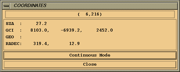
The geographic latitude, longitude, and altitude of pixels whose line of sight itersects the earth are displayed when appropriate. The right ascension and declination of the point on the line of sight closest to the earths surface are displayed when appropriate. The corresponding GCI coordinates and solar zenith angles are always computed and displayed.
Figure 7 shows the coordinate window. The window will be updated continuously as the cursor is moved when in continuous mode. If click mode is selected, the coordinates will only be updated when the left mouse button is clicked in the image.